Targeted spraying,
mapped in minutes.
Draw precise application zones, calculate accurate areas, and export ready-to-use files for your sprayer terminal.
Open TaskMaps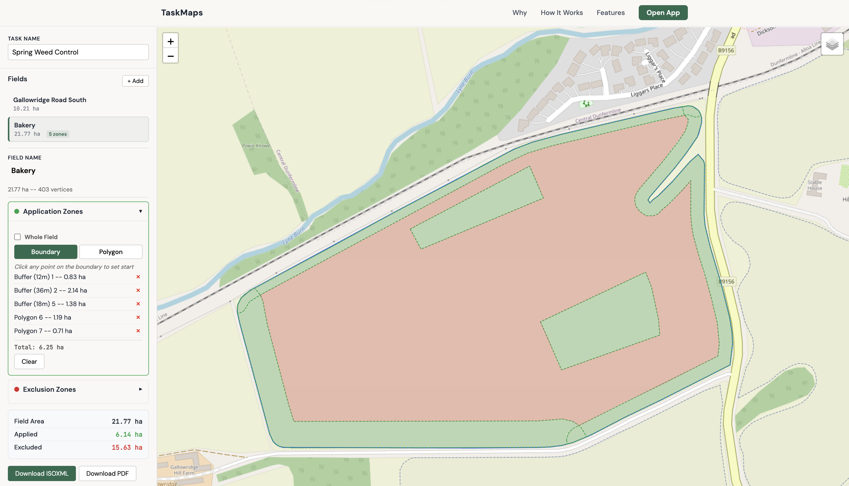
Draw precise application zones, calculate accurate areas, and export ready-to-use files for your sprayer terminal.
Open TaskMaps
The Problem
Inaccurate area estimates mean over-ordering product or running short mid-job.
Verbal instructions and hand-drawn maps leave room for operator error.
Assurance schemes need clear records. Scribbled notes don't cut it.
The Solution
Know exactly how many hectares you're treating before you order product. No more guesswork, no more waste.
Every operator gets the same map. Export ISOXML direct to the terminal — no interpretation needed.
One-click export with mapped zones, area breakdowns, and dates. Ready for assurance scheme inspections.
How It Works
Drop a Shapefile of your field boundary, or draw on the map
Mark application and exclusion zones on the map
Download ISOXML for your terminal, or a PDF report
Features
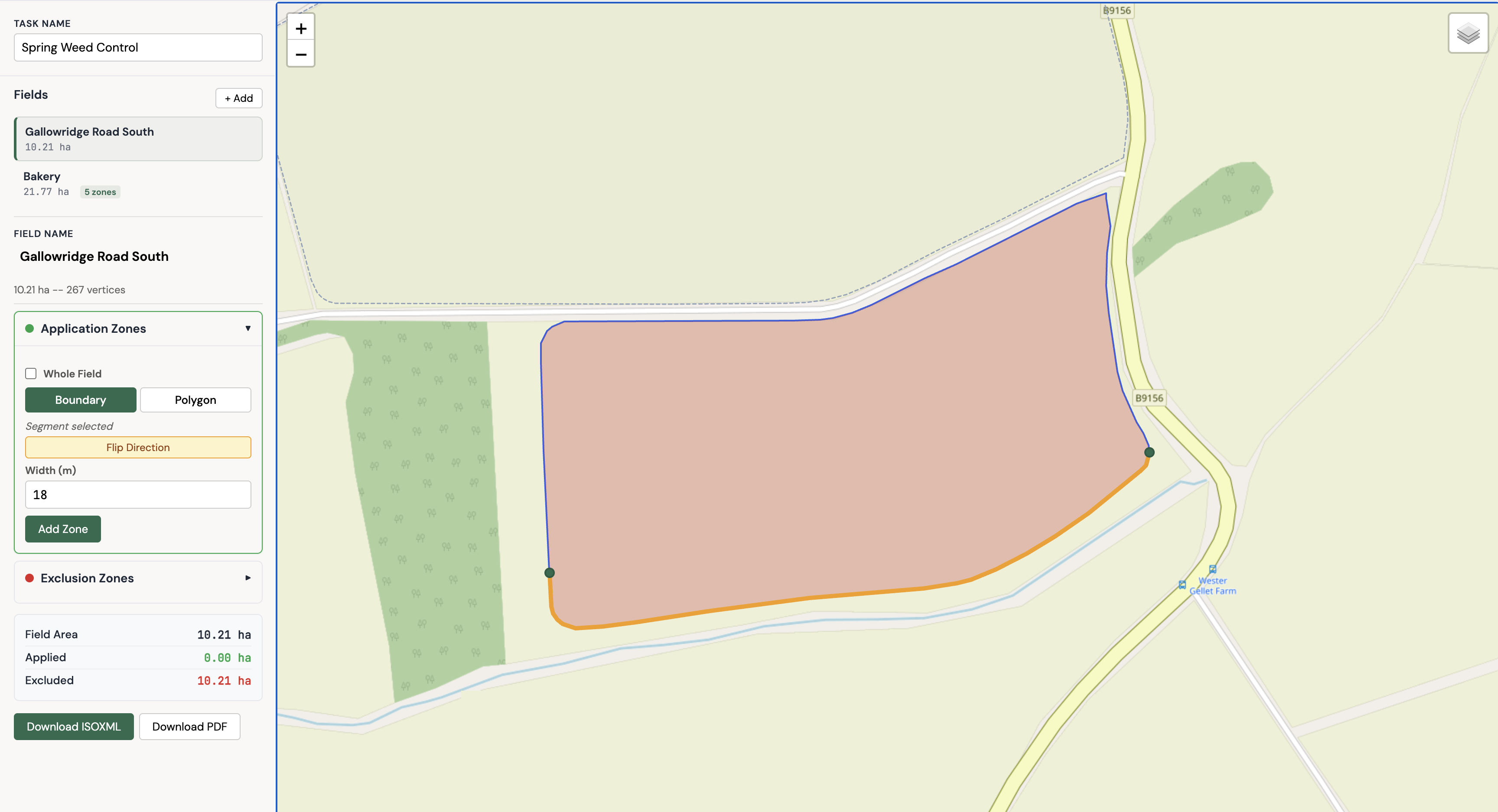
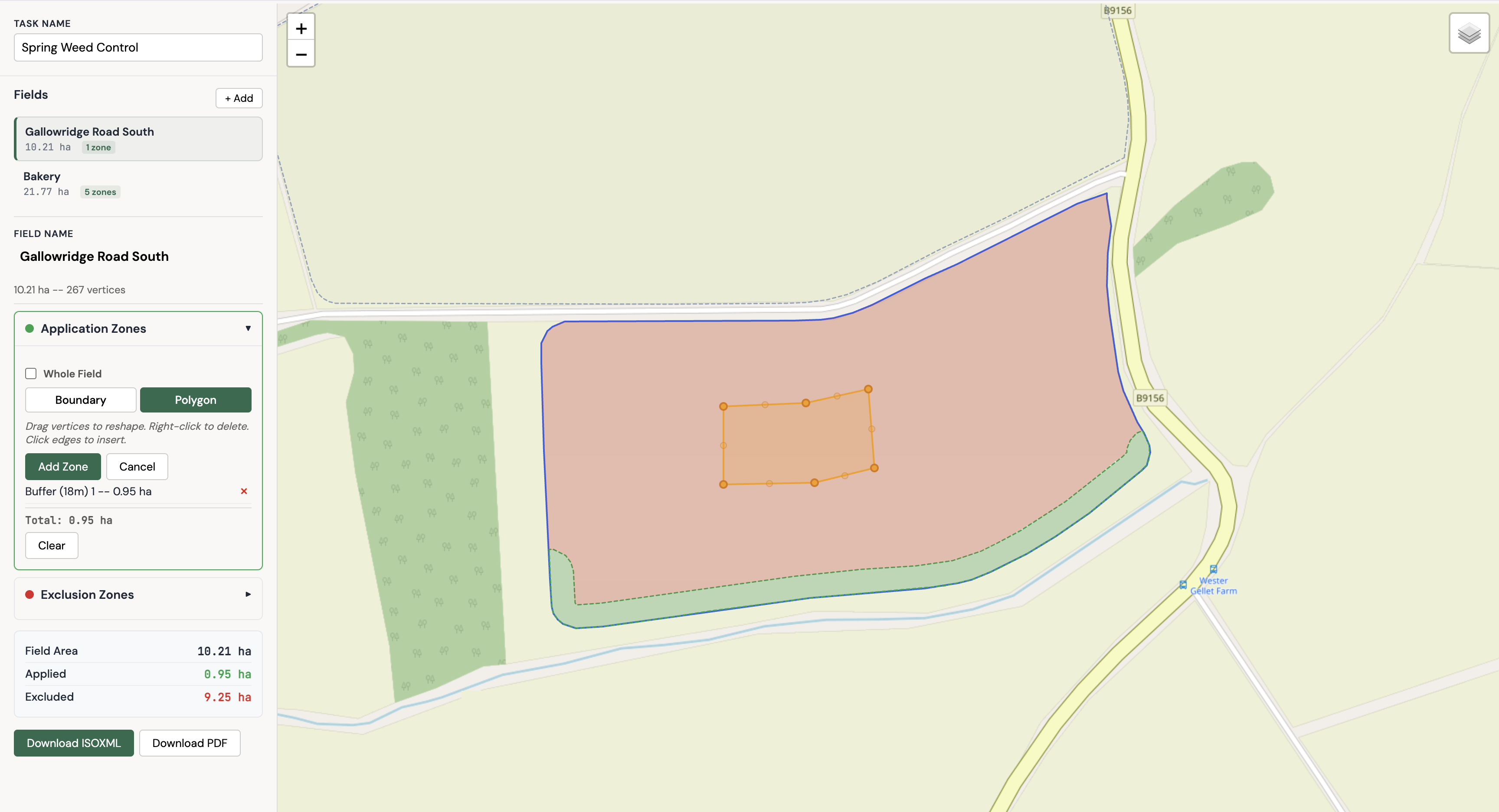
Trace along boundary edges to create buffer strips, or draw freeform polygons for irregular zones. Accurate to the metre — know exactly how much area you're treating before you order chemical.
<ISO11783_TaskData>
  <PFD A="PFD1" C="Bakery" D="217700">
    <PLN A="1"><LSG A="1">
      <PNT C="55.891" D="-2.674"/>
      <PNT C="55.893" D="-2.671"/>
    </LSG></PLN>
  </PFD>
  <TSK A="TSK1" B="Spring Weed" E="PFD1" G="1">
    <TZN A="1" B="Buffer 18m"><PDV A="0001" B="1"/></TZN>
  </TSK>
</ISO11783_TaskData>Your sprayer applies exactly where specified — no guesswork, no operator interpretation. Copy to USB and go. Works with any ISOBUS terminal.
Upload .zip shapefiles or draw field boundaries on the map
Share with operators, show your agronomist, or file for assurance scheme compliance. Every zone clearly mapped with areas.
Create a prescription map in under 5 minutes
Built by a working arable farmer. Used on real fields, every season.